Cannon Mountain

Date: June 19, 2010
Trails: Lonesome Lake trail --> Lonesome Lake --> Kinsman Ridge trail --> Cannon Mountain --> Hi Cannon trail --> Lonesome Lake trail --> Trailhead

For our first 4000 footer of the year, we planned a stay at the Kinsman Lodge in Franconia, just around the corner from Franconia Notch. We drove up after work Friday night, stayed the night, and planned to hike Cannon Mountain on Saturday.  In the morning, we were treated to a delicious breakfast of fruit, eggs, and buckwheat pancakes by Chet and Sue, the innkeepers at the Kinsman Lodge.  After breakfast, we made our way over to Cannon Mountain.

Cannon Mountain is a popular ski mountain and the former site of the Old Man in the Mountain.  It's one of the most recognizable mountains in the White Mountains, standing tall over route 93 as you pull into Franconia Notch.  We were excited to do this hike as we had driven by Cannon many a time, and would now be able to say that we had been on top of it.

We started our hike from the Lafayette Campground, just off of route 93.  The hike started via the Lonesome Lake trail, which climbs at a moderate pace for just over a mile before reaching Lonesome Lake.  The lake is situated at 2,730 ft. above sea level, nestled in between Cannon Mountain and the Kinsmans.  We stopped for a quick break and a snack at the north east shore of the lake, then continued along the trail towards Kinsman Ridge.

Once we made it to the Kinsman Ridge trail, we started a quick and steady uphill climb.  Before long, we found ourselves at a very steep section, where we had to do some rock scrambling.  This section continued on for a while, for what seemed like forever, but as we kept going, the views started to open up behind us.  We could see the Kinsmans off in the distance, and the view was getting clearer and clearer as we ascended.  As we approached the summit, the trail mellowed out, and a bit later, we found ourselves at a clearing.  At this point, we walked along the outer ridge near the aerial tramway.

At the ridge, we were provided with a straight on view of Franconia Ridge (Mounts Lincoln, Lafayette, Haystack, Liberty, and Flume).  We also were able to see the tram and chat with some of the people who had come up via the tram.  It was kind of fun to see people's reactions to the fact that we had not taken the tram, but rather had hiked up the mountain.  After taking some time to enjoy the views of Franconia Ridge, we made our way over to the summit.


On top of Cannon's summit is a large tower that offers 360 degree views.  We walked up the tower and took in the views for a bit.  It was windy and a bit chilly at the top of the tower, so we made our way back down and over to the Summit Cafe.  As we rounded the corner to the Cafe, we were hit with a familiar smell - french fries, burgers, and chicken fingers.  We decided that it was in our best interest to skip the fried food since it would sit in our stomachs on the way down. 

After enjoying one last view from the top, we started to make our way down.  We descended via the Hi Cannon Trail, which is a more direct route to the bottom.  It turned out that this trail was less steep than the Kinsman Ridge trail and was easier going down.  About halfway down the trail, we were able to get a nice birds-eye view of Lonesome Lake from a small ridge just off the trail.

As we reached the bottom, we were tired but happy with our hike.  We had been lucky enough to have perfect weather, Lonesome Lake had been a great sight along the trail, and the views from Cannon were spectacular.  The good news - now we can justify taking the tram to the top in the future!

Sugarloafs


Date: June 14, 2010
Trails: Sugarloaf trail --> North Sugarloaf trail --> North Sugarloaf --> Middle Sugarloaf trail --> Middle Sugarloaf

To kick off the 2010 hiking season, we picked an easy hike to help get ourselves into shape. The Sugarloaf mountains are two small mountains located in Twin Mountain just off of route 302, near the Zealand campground. We had read that these mountains, despite their low elevation, had nice open summits, so we thought it would be a good hike to start off the summer.

This hike was relatively easy but still gave us enough of a workout to help get us into shape. The entire hike to both peaks is about 3.4 miles, and the summits offer awesome views of Twin Mountain and the surrounding ranges. This was not a very difficult hike, but it was perfect as a first hike of the year. We hit North Sugarloaf first, enjoyed the view a bit, then made our way over to Middle Sugarloaf. We enjoyed lunch on the top of Middle Sugarloaf, took in some views, then headed back down.

Overall the hike took us about 3 hours. It definitely provides one of the best views for the level of effort that we've experienced so far.

Frankenstein Cliffs and Arethusa Falls


Date: October 25, 2009
Trails: Frankenstein Cliffs trail --> Frankenstein Cliffs --> Frankenstein Cliffs trail --> Arethusa Falls --> Arethusa Falls trail --> Beamis brook trail

To take in a bit of the foliage, I decided to take Karen on a hike I had done a couple years earlier, Arethusa Falls and Frankenstein Cliffs. To mix it up a little, this time we went the opposite way that I had gone before.

I've already written the details about this trail, but wanted to post a few pictures from the second time around since it offers such great fall scenery.


Mount Jackson

Date: September 19, 2009
Trails: Webster-Jackson trail --> Jackson Branch --> Mount Jackson


Based on a suggestion from a friend, Karen and I decided to make Mount Jackson our next 4000 footer. Mount Jackson is located off of Route 302 in Crawford Notch State Park, near Elephant's Head (a cool rock formation that resembles an Elephant, shown in the picture on the left). Mount Jackson is commonly coupled with Mount Webster, as the two peaks are just over a mile apart along a ride. We had originally planned to do both peaks, but after getting a late start, we made the decision to stick to doing just Jackson.

We got into NH and got out of the car to a brisk 50 degree morning. Luckily we had packed a lot of warm clothing because it was a COLD start to the hike. As the day went on, the sun reached it's peak, and as we got ourselves moving, we warmed up a lot. We started south east along the Webster-Jackson trail towards Elephant's Head. This was one of the better maintained trails that we have hiked on so far, with good footings and for the most part a moderate grade. About a mile and a half in, the trail breaks off, with one trail going towards Webster and one towards Jackson. We followed along the Jackson trail, which turned steep fairly quickly. We had to scramble up some rock faces and navigate some tough boulders.

As we rounded the corner, the last 600 feet or so to the summit was a wide open, exposed rock face with awesome views of Mount Washington and the Presidential Range. We felt the wind as we got more and more exposed at the summit, and by the time we made it to the top, the wind caused it to feel as if they were below 50 degrees. We loaded up on the layers and spent some time enjoying the views from the summit. Being a bald summit, Jackson offers 360 degree views of the surrounding area, including Crawford Notch, Mount Webster, and the Presidential Range. We were able to enjoy the summit for a short amount of time - however, before long, the wind got to us and we started to make our way back down.

Our trip back down was quick given the moderate grade and good footing. As we got to the junction of the Webster and Jackson trails, we took a quick pit stop to see the small waterfall at the beginning of the Webster trail.

To date, this was our favorite hike. It will definitely be one that we re-visit in the future.

Mount Major

Date: September 6, 2009
Trail: Mount Major trail --> Mount Major

With the new hiking season in full swing and several hikes completed/planned, it's time I catch up on my backlog of hikes. I'll start with a hike from last September, which I did with Karen and an old friend from high school, Bill.

This hike was a pretty spur of the moment trip. Bill and I had been chatting one day about his hike of Mount Monadnock and I mentioned that we should do a hike together sometime. One weekend at the beginning of the fall, Karen and I had nothing planned and decided to call up Bill and hike Mount Major.

This hike, while not a 4000 footer, is an extremely popular one and the thing I remember about pulling up to the trailhead was the amount of cars - the entire lot was full, with cars lined up along the highway. We ended up parking about a quarter of a mile down the road. We met up with Bill at the trailhead and started our ascent.

Mount Major is located basically right next to Lake Winnipesaukee, and is a fairly easy hike - one that a lot of families and inexperienced hikers do. We started up the trail at a moderatepace before coming to a group of rock slabs. These were fairly easy to climb and as we got higher, the lake came into sight. After about an hour of hiking we arrived at a nice lookout to get our first view of the lake. This was a good time for us to stop, have a quick water and snack break, and snap a few pictures.

We continued on up a steep set of rock slabs and more and more of the lake came into view. The terrain was wide open and offered a lot of good places to sit and take a break. We took it slow so as to enjoy the views and after long, made it up to the summit of Major. This was probably the most crowded peak that we have done to date - families, school trips, dogs, etc. It was around lunch time so we decided to eat our sandwiches at the top and take in the view.

We headed back down via adifferent trail to get some different scenery and enjoyed the second trail a lot more than the first. Eventually the trail met back up with the main trail and we madeit back to our car. The hike was perfect for being a spontaneous trip - short and close enough to work as an up and back in a day trip. Definitely a recommended hike for anyone of all experience levels.

Mount Tecumseh (almost...)

Date: August 1, 2009
Trails: Mount Tecumseh trail

For a weekend at the beginning of August, we planned a trip to Waterville Valley, for two purposes - to go kayaking, and to try and bag another 4000 footer. Waterville Valley lies between three 4000's - Mount Tecumseh, Mount Osceola, and East Osceola. Osceola and East Osceola are typically done together, and since we had other things planned for the weekend, we decided to go with the shorter hike of Tecumseh so that we'd have time to do all that we wanted on the weekend.

There are two routes to get up to the summit of Tecumseh - one that leaves from the Waterville Valley ski area east of the mountain, the other going from Tripoli Road north of the mountain. We had heard that the Tripoli Road trail was better, and slightly more challenging, so we decided to go with this one. The route up was very moderate the whole way, with not a whole lot to look at on the way up aside from a few nice looking streams (like the one shown in the picture above). After about two hours, we reached a clearing that looked out on the Valley, and seeing as there were no higher points to be seen, we thought we had reached the summit. We sat here and ate lunch, took some pictures, then headed down to go kayaking for the afternoon.

Turns out, we never actually made it to the summit of Tecumseh. The spot that we had stopped in was about a half mile short of the summit. When we found this out later that night, we were pretty disappointed - we had turned around not because we were tired, not because the weather was bad, but because we did not realize that where we were was not quite the mountain's summit. Unfortunately, even though we had put in all that work, we did not get to cross Tecumseh off our list.

We were so disappointed that we almost got up the next morning and tried again from the ski area - but we decided that it was not worth wasting another day, and that we would come back somewhere down the line. Despite the disappointment with the hike, we definitely had a fund weekend, and will definitely be back to try again.

Willey Range and Mount Avalon


Date: June 26, 2009
Trails: Avalon trail --> A-Z trail --> Willey Range trail --> Mount Field --> Willey Range trail --> Mount Willey

This past weekend marked #2 and #3 on the 4,000 footer list with Mount Field and Mount Willey. The Willey Range is a string of mountains in Crawford Notch, which includes three 4000 footers - Mount Tom to the north, Mount Field in the middle, and Mount Willey to the south. Since I had already done Mount Tom, we had planned to do Mount Field and Mount Willey as a combination hike to knock off the rest of the Willey range.

We left Friday morning early and made our way up to Crawford Notch for this hike. The hike started from the Crawford Depot trailhead off route 302, the same one as Mount Avalon and Mount Tom, both of which I had done a couple years ago. The plan was to definitely do Mount Field and Mount Willey, and possibly do Mount Tom and / or Mount Avalon if we were feeling up to it.

We started out on the Avalon Trail, which was nice and flat for about the first mile or so. The trail runs along a scenic river, and eventually crosses over the river before getting a little bit steeper. When I did this trail previously, crossing the river was a bit of an obstacle - however, this time, despite all the rain we'd had in the days before, the stream was running fairly shallow and we were able to cross with little to no effort. After about 1.5 miles, the trail splits - the Avalon Trail goes to the left, while the A-Z trail goes to the right towards Mount Tom. The faster way to get to Mount Field is by going left, but we decided to go right as it appeared to be the easier path. We learned later that both ways were equally challenging.

This trail took us across another river, then quickly up a steep slope. At this point, the sky started to get dark, and we were expecting rain any minute. We had packed the right clothing to keep us warm and dry, but were hoping the rain would hold off. We kept forward for another few miles, at a fairly steep pace the whole way, and got to the base of Mount Tom. In the interest of time, and since I had already done it, we decided to skip the .5 mile trail to Mount Tom and meet up with the Willey Range trail, which connects the three mountains. The Willey Range trail started off smooth, and the clouds began to clear, so we were in good shape heading towards Mount Field.

At this point, we had been hiking for about two and a half hours, and had yet to stop for lunch, so were starting to feel famished. We decided to push on for the last stretch to Mount Field and eat lunch at the summit. The climb up to Field began to get steeper and steeper, and before long, we reached a sign that indicated that we were 100 yards from the summit of Field. We pushed on, scrambled up a fairly steep set of rocks, and found ourselves looking over Crawford Notch and the Presidential mountain range from the summit of Field. We had completed our first 4000 footer of the day, and Karen's first ever. We sat at the summit, took some photos, and ate a well deserved lunch.

After our lunch break, we were feeling refreshed, and were ready to tackle the trek to Mount Willey. We descended the south side of Mount Field, which went down fairly quickly. In the back of our minds, we knew we'd have to go back up this stretch later on - but we kept heading through and eventually reached a valley between the two peaks. As we walked along this valley, the skies started to get dark again, and we again hoped that the rain would miss us. At one point during our ascent of Mount Willey, we almost turned back in the interest of time - but we had come this far, so there was no turning back. After a steep climb up another set of rocks, we reached the tree lined summit of Willey. The proper summit was overgrown and had almost no view of the valleys below, however, just beyond the summit was a wide ridge which provided a great view of Crawford Notch below. Aside from a slight drizzle on the top of Willey, the rain held off and we were able to stay nice and dry.

We debated descending the south side of Willey to take a shuttle back to the parking area at Crawford Notch, but since it was still reasonably early, we decided to go back the way we came. There was not a lot of space or whole lot to look at on the summit of Willey, so we spent only a few minutes there, took pictures, and started back for the car. As we were on our way back, the clouds broke up and we were treated to sunshine for the rest of the hike. Unfortunately, just has we had predicted, the hike back up to Field was a bit of a task, and by the time we made it back to the top, we were ready for another rest.

After a quick rest and some time to get organized, we began the descent down the Avalon trail. The trail down was very steep, and we could feel it in our knees that we had just done a long hike. We took our time with the descent, and after what seemed like an endless stretch, we reached the base of Mount Avalon. The peak was 100 yards away, and though we were tired and ready to get back to the car, we were so close we couldn't pass up the quick ascent. We got to the top, and were treated to an awesome view of the Notch, as well as a view behind us of Field and Willey (shown in the picture - Willey on the left, Field on the right). It put our whole trip into perspective - we saw how far we had gone, and realized that we'd covered a lot of land over the course of the day. Despite the extra push it required to get to the top of Avalon, we decided it was totally worth it.

After a quick break on top of Mount Avalon, we kept on our trip back down to the car. The stretch from the base of Avalon back to level ground again seemed to never end. By the end, we were feeling it big time in our knees. Once we finally got back to level ground, we had just another mile stretch back to the car - and although we were back walking on flat terrain, the parking lot could not come soon enough. We got back to the car as the sun was setting, very tired but happy with what we'd accomplished.

Middlesex Fells Skyline Trail

Date: June 13, 2009
Trail: Skyline Trail

This past weekend, to start to get ourselves into good hiking shape (and to break in some new hiking boots), Karen and I decided to head to Middlesex Fells in Medford to do the Skyline Trail. The reservation is about 10 minutes north of Boston, and very conveniently located right off Route 93. The skyline trail is just over 7 miles long, and throughout the hike there is over 1,000 feet of elevation gain - which is pretty impressive for a reservation so close to Boston. The trail is a loop that traverses the outskirts of the main section of the park, and climbs and descends several sets of hills, which together create the large elevation gain.

We started the loop climbing the hill to Wright's Tower, which is atop a hill just inside the reservation and overlooks Boston. Climbing through the woods, you don't really realize how close you are to Boston until you get to Wright's Tower. Once on top, you basically are looking straight down on 93 and out to the Boston skyline. The picture gives an idea, but it doesn't do justice to show just how close it is to downtown. The hike up to the tower is on a wide, well laid trail and takes only about 15 minutes. From this point the Skyline trail begins, and starts to go into a more wooded part of the Fells.

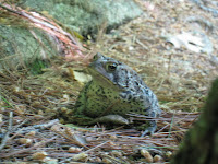
It was at this point that the hike started to feel less like a city hike and more like a true hike in the woods, as before long we could no longer see the roads around us and were surrounded by trees. One of the coolest parts of the hike was all the different types of wildlife in the reservation - in particular, the different types of frogs. Throughout the hike we saw all different types and sizes of frog. It always came unexpectedly, when we'd be walking and all of a sudden we'd see a frog jump out from next to us. Not something you see every day around the city, so it was definitely a cool addition to the hike.

Throughout the hike, there were a number of pretty steep upward climbs, which gave us the chance to help get ourselves into shape for hikes to come in the White Mountains. We finished the hike in about four and a half hours, and though we definitely had more stamina in us, we felt like we got a good workout. It was a great hike for being so close to home.

Arethusa Falls and Frankenstein Cliffs

Date: October 20, 2007
Trails: Bemis Brook Trail --> Arethusa Falls trail --> Arethusa Falls --> Frankenstein Cliffs trail --> Frankenstein Cliffs

For the second part of the two day hike I did with Ben and Will, we decided to do a loop, starting with Arethusa Falls and looping around across the Frankenstein Cliffs. We did this hike in October, right around peak foliage season, and the foliage was a major highlight of the hike. It's a long but not an overly difficult hike, and I would recommend it to anyone that wants to get a great view of the foliage in NH in the fall. The views of Crawford Notch are amazing, and hiking along the cliffs, there are a lot of openings and great views throughout.

We started at the trailhead and made a quick, easy trip into the falls. At about 160 feet, Arethusa Falls is the largest waterfall in New England. The hike into the falls took us a little under an hour - a fairly easy walk along a stream fueled by the falls. I had pictured it in my head, but as I came around the corner and saw the waterfall, I realized how big 160 feet really is. In the picture that I've attached here, you can see Ben and Will standing near the falls, which will give an idea of how big they really are.

We sat and ate lunch near the falls, took some pictures, and chatted with the people coming by. The trail leading to the falls is a very popular one, especially for families, so there were people coming in and out fairly frequently. Typically, people will come in to the falls and head back out the same way they came in. However, we decided to do the 3 mile loop along the cliffs to round out our hike.

The hike along the cliffs is probably the best hike I have done in NH to date. The cliffs are wide open at points, providing great views of Crawford Notch below. As we were there during peak foliage season, the colors were amazing. The pictures I took show amazing foliage, yet they don't even begin to do it justice. Having grown up in New England, I've grown accustomed to the foliage and never really knew what the big deal was - but after doing the cliffs, I understand why people come to New England specifically to see the foliage. Several times, we stopped to just sit and take in the views.

After a while of hiking, we made it back to the car and headed home. I was very sore the next day at work after doing a full weekend of hikes, but it was totally worth it. The trip officially gave me the NH hiking bug, and has been a major catalyst behind my desire to complete the 4k's.

Bald Knob

Date: May 24, 2009
Trails: Bald Knob Trail --> Bald Knob

Memorial Day has always been a favorite holiday weekend of mine, as it officially kicks off summer. The long weekend provides time off of work to do fun things, so this year, I decided it would be a good weekend for a hike.

A friend from work who grew up in NH suggested a hike near Lake Winnipesaukee , which combined two peaks - Black Snout and Mount Shaw. Karen and I looked it up online and decided that this would be a great hike for the weekend, so we made plans to go on Sunday. As of Friday, it was looking like our hike might not happen, as Karen had come down with a bad cold - but when Sunday rolled around, she was feeling up to it so we headed up into the mountains.

According to what we printed out, it said that the trailhead was difficult to find, and this ended up being very true. Turns out that, in trying to find the trailhead for Mount Shaw, we overshot it a bit and ended up at the trailhead for Bald Knob. By the time we realized we were on the wrong trail, we were already a ways into it, so we decided to keep going and see where it took us. It ended up being a great decision. We got a late start, and Bald Knob ended up fitting our time frame better - a shorter hike, but still difficult enough to give us a good workout and a great view of the Lake.

The hike started off not so fun - rain was heavy at times at the beginning, which led to an increase in the amount of mosquitoes on the trail. Pair this with the fact that both Karen and I had grown out of shape over the long winter, and we had a tiring, wet beginning to our hike, all while constantly fending off mosquitoes. At one point, we reached a slippery, steep rock face, which took us a bit of time to navigate - but slowly and carefully, we scrambled up the rock face and kept on our way up.

The hike got steeper after the rock face, but we noticed the trees clearing as we went further and further up. Along with the trees clearing, the sky appeared to be clearing as well, and after a short push, we made it to a small open ridge, with a great view of the lake. Along with the view, we were able to enjoy the rest of our lunch and were temporarily relieved from the mosquitoes.

After a quick rest and some picture taking, we turned to make the last push to the summit of Bald Knob. This was probably the steepest part of the trail, and we were led to climb eroded tree roots and scattered sets of rocks. We had to take a few breaks to make it all the way up, but once we made it, it was totally worth it. The views from the ridge atop Bald Knob were amazing - and we were lucky to be the only ones on the peak, so we were able to enjoy the peace and quiet while looking out over the lake. By this point, the skies had cleared and we were treated to a nice sunny peak.

After a bit of time spent at the top, we began heading back down. The hike back down proved to be almost just as pressing as the hike up - in particular, the rock face, which had dried slightly, but not enough to make it any less slippery. Karen, who was wearing running shoes with slippery soles, took a bit of a tumble coming down - but toughed it out and kept a smile on her face (and the next day, went to LL Bean to buy hiking boots to make sure it doesn't happen again!). Coming down, we realized how far we had gone - and got to take in some more of the scenery of the first stretch, which we had missed among the rain and mosquitoes.

Overall, it was a great first hike of the season - not exactly what we had planned, but overall, a lot of fun and great scenery. At the very least, it got us excited for a summer full of hikes, and hopefully a few 4000 footers along the way. Over the weekend, Karen and I discussed getting a group together to do Mount Isolation - a 4k in the Mount Washington area which is supposed to be a great hike. Hopefully I will be writing about that one soon!

Mount Avalon and Mount Tom

Date: October 19, 2007
Trails: Avalon Trail --> Mount Avalon --> A-Z Trail --> Mt. Tom Spur --> Mount Tom

To kick off my blog, I'll start with a set of hikes I did in October of 2007 with my current roommate, Ben, and my roommate from college, Will.

Ben and I work together at a public accounting firm, and had just started work about a month before. We got to talking one Tuesday night about wanting to do a hike in New Hampshire, and before long, we had booked a hotel for that coming Saturday, found a third hiking companion, and were ready to head up for our first white mountains hiking experience.

We left early Saturday morning, packed the car, picked up Will, and headed straight to Crawford Notch to begin our weekend with a dual peak hike, Mount Avalon and Mount Tom. At 4,051 ft above sea level, Mount Tom is one of the smaller 4k peaks. Mount Tom itself is overgrown and isn't much to write home about when it comes to views, but coupled with Mount Avalon (just below at 3,442 feet) it makes for a great hike.

We started our way up, talking and having fun, until we reached our first river crossing. I look back on it now and laugh, but being relatively inexperienced hikers at that point, we weren't exactly sure how to proceed. We spent the next 5 minutes trying to figure out the best way to cross using rocks as stepping stones, before realizing it was a lost cause. Before long, our shoes were off and were walking through the water to cross the river.

We kept on our way until we got to a junction, one path leading up to the summit of Mount Avalon, the other leading to the summit of Mount Tom. Because it was closer, we decided to hit Mount Avalon first. After a small scramble up a steep rock face, we found ourselves on top of Mount Avalon, looking over Crawford Notch. For anyone who has even a remote interest in hiking, this is a perfect peak to start with - a good workout but not too hard, with amazing views, especially in the fall when the foliage is in season. Show to the right is Ben, Myself, and Will atop Mount Avalon.

We climbed back down the rock face and continued on towards the summit of Mount Tom. We had been told that there wasn't much to see atop Mount Tom, as much of it was overgrown with vegetation, but we decided that because it was one the list of 4000 footers, we might as well cross one off the list. Back then, I really had no intention of climbing all of the 4000 footers, but looking back now, I'm glad that we made that decision to knock off Mount Tom.

As we got to the peak of Mount Tom, it started to cloud over and drizzle a little. Nothing that was too big of a deal, so we kept onward and eventually made it to the summit. As we made it to the top, the sun started to break through and we were treated to a nice view of the white mountains around us. At the very least, it made for a nice picture (shown to the left).

That night, we went for a beer and wings at the 99 Restaurant, where we watched the Red Sox complete their sweep of the LA Angels in the ALDS. We woke up the next day for another hike - Arethusa Falls and Frankenstein Cliffs, which I will talk about in a later post.

About My Blog

The reason for this blog is simple: I was at work the other day, talking with some co-workers about hobbies. Having just come off of our busy season, which entails regular 50-60+ hour workweeks, including frequent work on weekends, we were talking about how work had caused us to lose track of our hobbies.

I went home that night, thinking about this idea of keeping a hobby, and decided that I was going to continue something that I began in the fall of 2007 - climbing all 48 peaks in New Hampshire over 4000 feet. Hiking is something that I have recently come to enjoy, and over time, I hope to be able to hit all 48 peaks. So far, I have climbed only one 4000 footer, Mount Tom, which I will talk about for my first post to kick off the blog.

My plan is not to just focus on the 4000 footers and forget that there are other great hikes in New England - rather, it is to pursue my hobby of hiking, and along the way, attempt to climb all 48 peaks. Thus, I will include other hikes in this blog as well.